Fantastic Turkmenistan Map PowerPoint Presentation Slides

 Canva
Canva
Innovative Turkmenistan Map PowerPoint Template Five Nodes
Using our template, adding a better Turkmenistan map is not so tough. Get our Turkmenistan Map PowerPoint Presentation Slides to provide a clear picture of the Turkmenistan map in the presentation. You will also learn some essential Map PowerPoint leads using our Turkmenistan Map. Finally, you will be satisfied with the outcomes that you will achieve.
About This Slide:
The five text areas and different shades on the Map help users add their information. Also, We have a pack of templates for the practical Map PPT slides. You can choose between many shades in our Turkmenistan Map PowerPoint Slides. However, Users can change the size of the font, the format of the United States Of America Map Template, and the borders.
Features of this template
1.100% Customizable (shape color, size & text)
2.This template has a colorful theme.
3.Drag and drop image placeholder
4.Huge Collections of Map slides to impress your audience
5.This map slide supports 16:9 and 4:3 format
6.Easily readable and acceptable template.


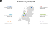
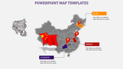
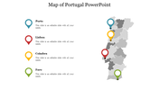
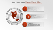
You May Also Like These PowerPoint Templates
Add to Wishlist
Download
Edit

Add to Wishlist
Download
Edit

Add to Wishlist
Download
Edit

Add to Wishlist
Download
Edit


Add to Wishlist
Download
Edit

Add to Wishlist
Download
Edit


Add to Wishlist
Download
Edit

Add to Wishlist
Download
Edit

Add to Wishlist
Download
Edit

Add to Wishlist
Download
Edit

Add to Wishlist
Download
Edit

Add to Wishlist
Download
Edit

Add to Wishlist
Download
Edit


Add to Wishlist
Download
Edit

Add to Wishlist
Download
Edit

Add to Wishlist
Download
Edit
