PowerPoint Country Maps Presentation PPT Slides

 Canva
Canva

Dynamic Country Maps for Engaging Presentation Slide
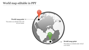
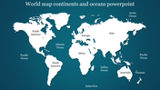
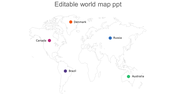
Experience the power of our Country Maps template Picture five vibrant circular posts showcasing the flags of North Africa, Brazil, Africa, Russia, and Australia against a world map backdrop. This visually stunning slide is your go-to tool for presentations, reports, or academic projects.
With seamless integration, customize these maps effortlessly to illustrate regional data, compare statistics, or highlight global trends. Tailored for business analysts, educators, researchers, and students, these templates elevate your presentations to new heights. Impress your audience with professional-grade visuals that captivate and inform. Elevate your message, make an impact, and download our PowerPoint Country Maps template today. Unlock the potential of your data like never before!
Features of the template
- 100% customizable slides and easy to download.
- Slides are available in different colors
- The slide has 4:3 and 16:9 formats.
- Easy to change the slide colors quickly.
- Appealing Presentation to impress an audience.
- Create feature-rich slide presentations.
- An eye-pleasing color slide helps to give a catchy display.
- It is apt with PPT and Google Slides.


You May Also Like These PowerPoint Templates
Add to Wishlist
Download
AI Customize

Add to Wishlist
Download
AI Customize

Add to Wishlist
Download
AI Customize

Add to Wishlist
Download
AI Customize

Add to Wishlist
Download
AI Customize


Add to Wishlist
Download
AI Customize

Add to Wishlist
Download
AI Customize

Add to Wishlist
Download
AI Customize

Add to Wishlist
Download
AI Customize

Add to Wishlist
Download
AI Customize

Add to Wishlist
Download
AI Customize

Add to Wishlist
Download
AI Customize

Add to Wishlist
Download
AI Customize

Add to Wishlist
Download
AI Customize

Add to Wishlist
Download
AI Customize

Add to Wishlist
Download
AI Customize

Add to Wishlist
Download
AI Customize

Free
Add to Wishlist
Download
AI Customize

Add to Wishlist
Download
AI Customize
