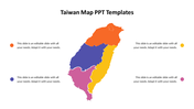
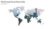
Map PPT Template For Presentation Slides

Map PPT template highlighting key cities in Great Britain such as London, Manchester, and Edinburgh with placeholder text.
P.ID : 8544
    331 views
    24 Downloads
    Get Custom Slides by Experts
    Instantly Access Templates in PowerPoint

    Map PowerPoint Template and Google Slides Themes


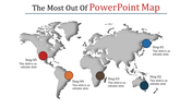
    Start on a captivating journey through Great Britain with our 'Map PowerPoint Template and Google Slides Themes.' This unique template features six interactive nodes, each unveiling a different facet of this historic land. 

    Ideal for historians, educators, and travel enthusiasts, the template's immersive design includes captivating captions, title holders, and text areas, perfect for engaging storytelling. Seamlessly blending history and geography, this modern twist on presentations is designed to captivate audiences and elevate your content.

    Whether elucidating Britain's rich history or showcasing its stunning landscapes, this template is your compass for informative and visually stunning presentations. Transform mundane data into captivating stories, leaving a lasting impression with every slide. Download now.

    Features of the Template

    • 100 % customizable slides.
    • The   slide show is in 4:3, 16:9, zip format.
    • There is powerful connectivity with Google Slides and PowerPoint.
    • It is simple and quick to alter the slide's color.
    • An efficient template that can be easily accessed immediately.
    • Well-crafted template with an instant download facility.
    Advertisement

    You May Also Like These PowerPoint Templates

    Add to Wishlist
    Download
    AI Customize
    World map slide with location markers for countries from England to Africa, with a caption.
    Add to Wishlist
    Download
    AI Customize
    Creative Indonesia PPT PowerPoint Template Designs
    Add to Wishlist
    Download
    AI Customize
    Nigeria map presentation with a highlighted region and four captions with percentage indicators.
    Add to Wishlist
    Download
    AI Customize
    World map infographic highlighting Denmark, Russia, India, and Colombia with dotted lines connecting to captions.
    Free
    Add to Wishlist
    Download
    AI Customize
    Map with regions in blue, orange, yellow, and gray next to horizontal bar charts in matching colors with percentages.
    Add to Wishlist
    Download
    AI Customize
    Grayscale Netherlands map with six colored dots in blue, red, green, purple, teal, and orange, linked to text on both sides.
    Free
    Add to Wishlist
    Download
    AI Customize
    PowerPoint Map Templates for Geographical Data Presentation
    Add to Wishlist
    Download
    AI Customize
    Portugal map with four location markers in blue, red, yellow, and green, each linked to descriptions aligned on the left.
    Add to Wishlist
    Download
    AI Customize
    Argentina map slide with regions highlighted in different colors and six pie charts showing varying data percentages.
    Add to Wishlist
    Download
    AI Customize
    Australia map template showing three labeled points, linked to percentage metrics and text placeholders.
    Add to Wishlist
    Download
    AI Customize
    Map of Turkey with six regions highlighted in different colors, each marked with a label and arrow.
    Add to Wishlist
    Download
    AI Customize
    Illustration of a rider on a horse over a red Turkey map with flags, mosques, and flying planes, and text on the right.
    Add to Wishlist
    Download
    AI Customize
    Infographic of France highlighting regions in blue, red, and white, with explanations about the symbolism of colors.
    Add to Wishlist
    Download
    AI Customize
    Colored world map showing North America, South America, Africa, and Australia, each highlighted in distinct shades.
    Free
    Add to Wishlist
    Download
    AI Customize
    Ecuador country map with six labeled location pins for cities like Ibarra, Nueva, Montalvo, Riobamba, Macas, and Santa Elena.
    Add to Wishlist
    Download
    AI Customize
    Blue shaded Great Britain map showing regional populations, alongside two percentage circles and a numbered list.
    Add to Wishlist
    Download
    AI Customize
    World map with six labeled location markers and travel path, set against a bright blue background.