Simple Jamaica Map Outline PowerPoint Presentation Template

Simple Jamaica Map Outline PowerPoint Presentation Template
Download this Simple Jamaica Map Outline PowerPoint Presentation Template for all your geographical-related data representations. This is a user-friendly template. It is a professionally well-designed template. It is a ready-to-use template.
This Simple Jamaica Map Outline PowerPoint Presentation Template has a political map outline of the Jamaican region. Jamaica is the largest island of the Caribbean Sea. It lies 630 kilometers northeast of mainland Central America. This template has the map outline as its central themed feature. This is a four nodded template. Each node is denoted by the name of the states in the Jamaican country.
Use this elegant template for all your geographical and survey-related data representations.
Features of this template:
- 100% customizable slides and easy to download.
- Slides available in different nodes & colors.
- The slide contained 16:9 and 4:3 format.
- Easy to change the slide colors quickly.
- Well-crafted template with instant download facility.
- One of the best location-related data representations.
- Premium template at the budget-friendly sum.


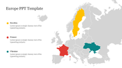
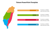
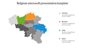
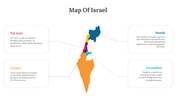
You May Also Like These PowerPoint Templates
Add to Wishlist
Download
AI Customize

Add to Wishlist
Download
AI Customize

Add to Wishlist
Download
AI Customize

Add to Wishlist
Download
AI Customize

Add to Wishlist
Download
AI Customize


Add to Wishlist
Download
AI Customize

Add to Wishlist
Download
AI Customize

Add to Wishlist
Download
AI Customize

Add to Wishlist
Download
AI Customize

Add to Wishlist
Download
AI Customize

Add to Wishlist
Download
AI Customize

Free
Add to Wishlist
Download
AI Customize

Add to Wishlist
Download
AI Customize

Add to Wishlist
Download
AI Customize


Add to Wishlist
Download
AI Customize

Add to Wishlist
Download
AI Customize

Add to Wishlist
Download
AI Customize

