Explore Ohio with Map Presentation Template

Slide with a map of Ohio featuring three location markers in blue, green, and orange, numbered caption and percentage.
P.ID : 35017
    13 slides
    Map slides of Michigan featuring upper and lower Peninsula counties in red and blue, along with geographic details.
    16 slides
    Slide deck featuring various Texas county maps with different colors and layouts for presentations.
    14 slides
    A pack of slides showing the map of Northeast region of the US, with each state highlighted in different colors.
    51 views
    4 Downloads
    Get Custom Slides by Experts
    Instantly Access Templates in PowerPoint

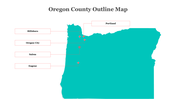
    Captivating Ohio Map Presentation Template


    Embark on a visual journey through Ohio with our meticulously crafted Three Node Map Presentation template. Perfect for business presentations, this predesigned PowerPoint template offers an engaging way to showcase geographic information with clarity and style. With three nodes strategically placed, you can effortlessly highlight key areas of interest, demographic data, or business locations across the state. The multi-color theme adds vibrancy and visual appeal to your presentation, ensuring that your audience remains captivated throughout. Whether you're analyzing market trends, planning business expansions, or simply educating your audience about Ohio, this user-friendly template provides the perfect platform to convey your message effectively. Elevate your presentations and leave a lasting impression with our Ohio Map Presentation PowerPoint.


    Features of this template:

    • 100% customizable slides and easy to download.
    • Slides available in different nodes & colors.
    • The slide contained 16:9 and 4:3 format.
    • Easy to change the slide colors quickly.
    • Well-crafted template with instant download facility.
    Advertisement

    You May Also Like These PowerPoint Templates

    Add to Wishlist
    Download
    AI Customize
    Effective South Carolina Counties Map Presentation
    Add to Wishlist
    Download
    AI Customize
    A  county map of Kenya, highlighting specific regions having four  textboxes for detailed presentation.
    Add to Wishlist
    Download
    AI Customize
    Jamaica map slide outline with clear boundaries dividing the island's parishes with many labeled regions.
    Add to Wishlist
    Download
    AI Customize
    Color-coded map of Singapore slide highlighting different regions: northwest, northeast, central, southwest, and southeast.
    Add to Wishlist
    Download
    AI Customize
    Slide featuring a map of the United States highlighting Washington D.C. with a red dot and text area on the right.
    Free
    Add to Wishlist
    Download
    AI Customize
    Asia map slide with highlighted countries in different colors, labeled with text for location details.
    Add to Wishlist
    Download
    AI Customize
    UK map in varying shades of blue and four captions arranged vertically on the right, on a white background.
    Add to Wishlist
    Download
    AI Customize
    Visual representation of the four asian tigers with a map highlighting south korea, taiwan, hong kong, and singapore.
    Add to Wishlist
    Download
    AI Customize
    Color-coded map highlighting India, Bhutan, Bangladesh, and surrounding countries with five caption areas.
    Add to Wishlist
    Download
    AI Customize
    Asia Pacific map highlighting key countries with color-coded markers and space for corresponding descriptive text.
    Add to Wishlist
    Download
    AI Customize
    A world map slide showing continents with distinct colors and labels on a white background.
    Add to Wishlist
    Download
    AI Customize
    Indonesia map with regions in various colors and five icons representing different locations, each linked to captions areas.
    Add to Wishlist
    Download
    AI Customize
    World map showing five continents in blue and green tones with black and white location markers.
    Add to Wishlist
    Download
    AI Customize
    Outline map of Puerto Rico with key cities labeled, connected by lines to labeled boxes with a teal border.
    Add to Wishlist
    Download
    AI Customize
    Color coded map of indonesia showing different regions with percentage indicators and text sections for data.
    Free
    Add to Wishlist
    Download
    AI Customize
    Illustration of a gray map of India, connected to three horizontal color-coded text boxes, each with a small India map icon.
    Add to Wishlist
    Download
    AI Customize
    World map slide with continents labeled and shown in different colors.