Presentation Map Netherlands PPT Template & Google Slides

Four highlighted regions of the Netherlands map in yellow, blue, purple, and orange, each with corresponding captions.
P.ID : 49926
    300 views
    26 Downloads
    Get Custom Slides by Experts
    Instantly Access Templates in PowerPoint

    Four Netherland Maps With Marked Regions

    Make an outstanding Netherland map presentation using our ready-made Netherland PowerPoint slide. It is exclusively designed with various options so that you can edit it well. It comes with maps and has vast space to add texts. You can use this for education to show the various regions of the Netherlands. It has four text boxes in vibrant colors, and four Netherland maps with shaded regions. In addition, at the bottom below the text boxes, the names of the highlighted regions are added. You can pinpoint the map's location or region for better understanding. Customize the slide with your ideas and add more exciting designs, texts, fonts, etc. Grab Now!!!

    Features of the template

    • 100% customizable slides and easy to download.
    • Slides are available in different nodes & colors.
    • The slide contains 16:9 and 4:3 formats.
    • Easy to change the colors of the slide quickly.
    • Well-crafted template with instant download facility.
    • Chatbot model text boxes with bright colors.
    Advertisement

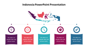
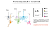
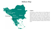
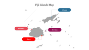
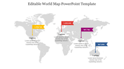
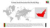
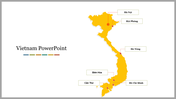
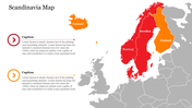
    You May Also Like These PowerPoint Templates

    Add to Wishlist
    Download
    AI Customize
    Berlin Infographics slide deck featuring a map outline of Berlin with the iconic  bear symbol in the center.
    Add to Wishlist
    Download
    AI Customize
    Vietnam slide deck with white backgrounds, featuring colorful maps, charts, and data on different regions and landmarks.
    Add to Wishlist
    Download
    AI Customize
    Printable grayscale world map outlining continents, labeled with names, on a white background.
    Add to Wishlist
    Download
    AI Customize
    A gray world map with colored markers showing percentages in yellow, red, purple, teal, and blue at various locations.
    Free
    Add to Wishlist
    Download
    AI Customize
    Four Argentina map with regions highlighted in red, green, blue, and orange, each with matching rectangular labels.
    Add to Wishlist
    Download
    AI Customize
    Map of Taiwan with four colored location markers and corresponding labels A, B, C, and D, each with placeholder text.
    Add to Wishlist
    Download
    AI Customize
    Map of Nigeria with four colored location markers along with dashed travel paths, and two circular data icons on the right.
    Add to Wishlist
    Download
    AI Customize
    Editable Nigeria PowerPoint Presentation Template Design
    Add to Wishlist
    Download
    AI Customize
    Color coded ecuador map slide highlighting key regions with text areas for manabi, pichincha, guayas, and los rios.
    Add to Wishlist
    Download
    AI Customize
    Map of Sri Lanka with four regions highlighted in teal, purple, yellow, and dark, listed with labels on the right.
    Add to Wishlist
    Download
    AI Customize
    Color-coded world map displaying different continents and indicating the names of each continent in the below boxes.
    Add to Wishlist
    Download
    AI Customize
    Collection of slides with white backgrounds, showing colorful continents and major oceans labeled clearly.
    Add to Wishlist
    Download
    AI Customize
    Jamaica map with highlighted regions in purple, orange, teal, and red, with corresponding labels and descriptions below.
    Add to Wishlist
    Download
    AI Customize
    Grey map of Mongolia with highlighted regions in red, purple, teal, and yellow, with corresponding text boxes.
    Add to Wishlist
    Download
    AI Customize
    Editable Map Of Italy Template PPT Presentation Slides
    Add to Wishlist
    Download
    AI Customize
    Slide deck illustrating multiple Denmark map layouts with charts, graphs, and visual data representations.
    Add to Wishlist
    Download
    AI Customize
    World map slide featuring six labeled continents with highlighting colors and each with text boxes.