Map Of The Northeast Region Of The US Google Slides


Northeast Region Map of US Presentation Slides
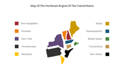
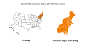
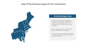
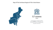
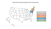
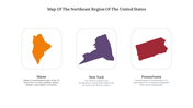
The Northeast Region of the United States is located in the northeastern part of the country and consists of 11 states: Maine, Vermont, New Hampshire, Massachusetts, Rhode Island, Connecticut, New York, New Jersey, Pennsylvania, Delaware, and Maryland. The region has a diverse landscape that includes mountains, forests, lakes, rivers, and coastal areas. Boston, New York, Philadelphia, and Baltimore are considered major cities in the Northeast Region of the US. Use our editable map of the Northeast Region of the US for your upcoming presentation. We have designed the slide with different hues and ample space for content. Our bundle highlights important cities and the unique features of each city with recently updated data. Engage your audience by showcasing our eye-catching map presentation.
Features of the template
- 100% customizable slides and easy to download.
- Slides are available in different nodes & colors.
- The slide contains 16:9 and 4:3 formats.
- Easy to change the colors of the slide quickly.
- Highly compatible with PowerPoint and Google Slides.
- Well-crafted template with an instant download facility.
- This is a flexible map template for easy understanding.
- It has a map of Northeast Regions of US.


You May Also Like These PowerPoint Templates
Add to Wishlist
Download
Edit

Add to Wishlist
Download
Edit

Add to Wishlist
Download
Edit

Add to Wishlist
Download
Edit

Add to Wishlist
Download
Edit


Add to Wishlist
Download
Edit


Add to Wishlist
Download
Edit

Add to Wishlist
Download
Edit

Add to Wishlist
Download
Edit

Add to Wishlist
Download
Edit


Add to Wishlist
Download
Edit

Add to Wishlist
Download
Edit


Add to Wishlist
Download
Edit

Add to Wishlist
Download
Edit

Add to Wishlist
Download
Edit

Add to Wishlist
Download
Edit

Add to Wishlist
Download
Edit

Add to Wishlist
Download
Edit

Add to Wishlist
Download
Edit

Add to Wishlist
Download
Edit

Add to Wishlist
Download
Edit

Add to Wishlist
Download
Edit

Add to Wishlist
Download
Edit

Add to Wishlist
Download
Edit

Add to Wishlist
Download
Edit

Add to Wishlist
Download
Edit


Add to Wishlist
Download
Edit


Add to Wishlist
Download
Edit

Add to Wishlist
Download
Edit


Showing36 of69,218 templates