Spectacular North America PowerPoint Slide For Your Wants

 Canva
Canva

Colorful Map Presentation
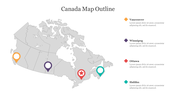
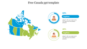
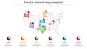
If you are considering giving a presentation on the world's third-largest continent, use our maps of North America's central region nations in PPT to show where lies between the bulk of the Arctic Circle and the Cancer Tropic. Use this Slide to describe the geographic limits that make this a unique continent with abundant natural aids. This PPT has vector-based file formats. Display visuals can be fully revised and have the flexibility to input data. Use this to learn about North America and its leading countries initially. Suitable for social science students, researchers, anthropologists, etc., try this to boom.
Features of the Template
- 100% customizable slides and easy to download.
- Slides are available in different nodes & colors.
- The SlideSlide contained 16:9 and 4:3 formats.
- Easy to change the slide colors quickly.
- Well-designed with a download option.
- Excellent dental presentation Template.


You May Also Like These PowerPoint Templates
Add to Wishlist
Download
Edit

Add to Wishlist
Download
Edit

Add to Wishlist
Download
Edit

Add to Wishlist
Download
Edit

Add to Wishlist
Download
Edit


Add to Wishlist
Download
Edit

Add to Wishlist
Download
Edit

Add to Wishlist
Download
Edit

Add to Wishlist
Download
Edit

Add to Wishlist
Download
Edit

Add to Wishlist
Download
Edit

Add to Wishlist
Download
Edit

Add to Wishlist
Download
Edit

Add to Wishlist
Download
Edit

Add to Wishlist
Download
Edit

Add to Wishlist
Download
Edit

Add to Wishlist
Download
Edit

Add to Wishlist
Download
Edit
