Free - Editable PowerPoint Canada Map Template & Google Slides

Free
Gray Canada map featuring labeled provinces and three colored caption boxes with icons on the right.
P.ID : 31451
    2.7K+ views
    588 Downloads
    Get Custom Slides by Experts
    Instantly Access Templates in PowerPoint

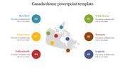
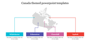
    Canada Map Presentation Slide

    Are you sure you want to win your presentation? Then, this map template will be helpful in your shortest dream come true. Canada is the second-largest country in the world, after Russia. By land area alone, Canada ranks fourth, due to having the world's largest area of fresh water lakes. The Canada map template typically includes the boundaries of Canada, as well as major cities, and other landmarks. The template also includes options for customizing the colors, fonts, and labels used on the map. So downloading and editing this template will give you the required result for your presentation.  

    Features of this slide:

    • 100% customizable slides and easy to download.
    • Slides available in different nodes & colors.
    • The slide contained 16:9 and 4:3 format.
    • Easy to change the slide colors quickly.
    • Well-crafted template with instant download facility.
    • Highly compatible with PowerPoint and Google Slides.
    Advertisement

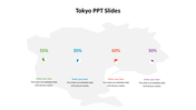
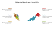
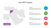
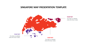
    You May Also Like These PowerPoint Templates

    Add to Wishlist
    Download
    AI Customize
    Balkan peninsula map slide showing country borders, accompanied by a text section for further description.
    Add to Wishlist
    Download
    AI Customize
    World map outline displaying seven continents and labeled oceans, set in an oval frame on a blue gradient background.
    Free
    Add to Wishlist
    Download
    AI Customize
    Color-coded map of Finland divided into regions with labeled placeholders placed in a white background.
    Add to Wishlist
    Download
    AI Customize
    Colorful map of Israel with marking regions, along with six color key for reference.
    Free
    Add to Wishlist
    Download
    AI Customize
    Map of Ireland showing selected counties, including Mayo, Louth, Kerry, and Kilkenny, with brief descriptions for each.
    Add to Wishlist
    Download
    AI Customize
    Kosovo map with different regions highlighted in colors, showing Mitrovica to Prizren with labeled pointers.
    Add to Wishlist
    Download
    AI Customize
    Moldova map highlighting Briceni, Faleshti, Cahul, Hincesti, and Transnistria in different colors with labels and lines.
    Add to Wishlist
    Download
    AI Customize
    Map of Pakistan with a highlighted circle indicating Islamabad, alongside green arrows showing population growth.
    Add to Wishlist
    Download
    AI Customize
    Outline map of Canada with four colorful weather icons indicating different regions with captions.
    Add to Wishlist
    Download
    AI Customize
    Gray shaded map of Canada showing major cities and captions in green circles with numbers on the right, from 1 to 5.
    Free
    Add to Wishlist
    Download
    AI Customize
    Gray outline map of Canada with colorful location pins marking vancouver, winnipeg, ottawa, and halifax.
    Free
    Add to Wishlist
    Download
    AI Customize
    Canada map divided into blue and green regions, paired with two circular icons showing percentages and captions on the right.
    Add to Wishlist
    Download
    AI Customize
    Innovative Canada PowerPoint Theme Template Designs
    Add to Wishlist
    Download
    AI Customize
    Creative Canada PPT Presentation Template Designs
    Add to Wishlist
    Download
    AI Customize
    Practical Canada PowerPoint Presentation Slide Design
    Free
    Add to Wishlist
    Download
    AI Customize
    Canada slide showing a map with data points indicating 40%, 10%, and 50% values for different regions with a caption.
    Add to Wishlist
    Download
    AI Customize
    Buy Now Canada PPT Template Presentation With Four Icons