All Seven Continents Map PowerPoint Slides

 Canva
Canva
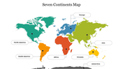
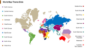
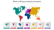
Seven Continents Map Slide For Presentation
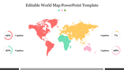
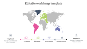
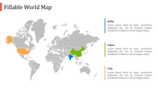
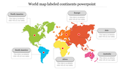
Would you like to talk about the seven continents? Here is a visual map picture to describe the landforms. Continents are the most extensive contiguous landforms. All school teachers can use this map layout to help elementary school students learn about the seven continents and the population density. The chart in this slide will show the size and population of each continent in a crystal clear way to the students. It is also 100% customizable, so you can easily opt for this slide for your classroom teaching.
Features of the template
- 100% customizable slides and easy to download.
- Slides are available in different nodes & colors.
- The slide contained 16:9 and 4:3 formats.
- Easy to change the slide colors quickly.
- It is a well-crafted template with an instant download facility.
- Mind-blowing slide for the presentation.
- Best templates for slideshows.


You May Also Like These PowerPoint Templates
Add to Wishlist
Download
Edit

Add to Wishlist
Download
Edit


Add to Wishlist
Download
Edit

Add to Wishlist
Download
Edit


Add to Wishlist
Download
Edit


Add to Wishlist
Download
Edit


Add to Wishlist
Download
Edit

Add to Wishlist
Download
Edit


Add to Wishlist
Download
Edit

Add to Wishlist
Download

Showing20 of69,218 templates