Printable Map of Continents and Oceans PPT and Google Slides


Colorful Printable Map Of Continents And Oceans PowerPoint
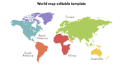
This Printable Blank Map Of Continents And Oceans PowerPoint looks like printed. It gives a wonderful and clear look to the slide. They additionally referenced all the continents names. At the point, when you purchase a clear guide, you should chip away at the guide by searching for the names, and shadings to get separated this cycle can be disappointing for individuals searching for a layout to alter to their requirements. A printable world map colored continents PowerPoint layout will be totally redone as per your necessities. With this, you can add any nation that you wish to show, any water regions that you want to show, and even include subcontinents.
Making a printable map of continents and oceans PowerPoint and seas PowerPoint format for introduction is simple, and you can even impart it to other people. All things considered, you will find that the layouts that you buy for the introduction are genuinely detailed. The continents on the map are shaded by purple, blue, green, orange, yellow, pink, and furthermore featured the landmasses' name. The slide is concealed with cool blue foundation colors that look improving and appealing. You can tweak continents and nations map PowerPoint to address your issues and set aside cash by having your guide printed to use on your introductions.
Making a printable map of continents and ocean PowerPoint layout is simpler than you might suspect. It is an incredible method to get your introduction made and afterward print it out whenever it might suit you. You will find that making a printable clear guide of mainlands and seas' PowerPoint layout is simple and should be possible rapidly. The new Printable Blank Map of Oceans and Continents is an extraordinary other option. It is an exceptional introduction that will clearly motivate you and your crowd. It is a visual portrayal of the seas, and continents of the world. The guide is planned in an alluring way that can without much of a stretch be perceived by all individuals, including kids. This data will assist you with distinctive geological highlights of the world.
Features
1. 100 % customizable slides and easy to download.
2. Slides available in different nodes & colors.
3. Slide contained in 16:9 and 4:3 format.
4. Easy to change the slide colors quickly.
5. Well-crafted template with instant download facility.


You May Also Like These PowerPoint Templates
Add to Wishlist
Download
Edit

Add to Wishlist
Download
Edit

Add to Wishlist
Download
Edit


Add to Wishlist
Download
Edit

Add to Wishlist
Download
Edit


Add to Wishlist
Download
Edit

Add to Wishlist
Download
Edit


Add to Wishlist
Download
Edit

Add to Wishlist
Download
Edit


Add to Wishlist
Download
Edit

Add to Wishlist
Download
Edit

Add to Wishlist
Download
Edit

Add to Wishlist
Download
Edit

Add to Wishlist
Download
Edit

Add to Wishlist
Download
Edit

Add to Wishlist
Download

Showing20 of69,218 templates