Editable World Map PowerPoint Template for Custom Use

Abstract world map design resembling torn paper outlines of continents on a white background.
P.ID : 34424
    195 views
    1 Downloads
    Get Custom Slides by Experts
    Instantly Access Templates in PowerPoint

    Editable World Map Presentation Template


    Understanding global dynamics and presenting geographic data effectively is crucial in today's interconnected world. Our Editable World Map PowerPoint template is designed to create engaging presentations with a global perspective.

    Slide Description:

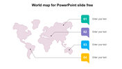
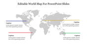
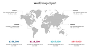
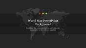
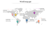
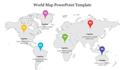
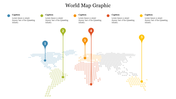
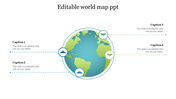
    Our slide features an editable world map in grayscale. Below the title, there’s a placeholder text box.

    Purpose of this slide:

    The purpose of this slide is to provide a visual aid for presentations that require a global perspective. It’s ideal for highlighting specific regions of the world or conveying geographical data.

    Who can benefit?

    Educators: Use it for geography lessons or international studies. Students: Enhance presentations on global topics. Business Professionals: Strategize international business plans. Marketers: Present demographic data with a global context.

    Download our templates now and start creating impactful presentations that resonate with your audience.

    Features of the template:


    •  Slides are available in 4:3 & 16:9
    • Get slides that are 100% customizable and easy to download
    • Highly compatible with PowerPoint and Google Slides
    Advertisement

    You May Also Like These PowerPoint Templates

    Add to Wishlist
    Download
    AI Customize
    Gray Russia map with six highlighted regions in purple, blue, green, yellow, pink, and red, paired with labeled text boxes.
    Add to Wishlist
    Download
    AI Customize
    Global map showing Hong Kong highlighted with a blue pin, along with a blue text placeholder.
    Add to Wishlist
    Download
    AI Customize
    Modern 3D infographic of Australia showcasing buildings, trees with capytion areas on a vibrant background.
    Add to Wishlist
    Download
    AI Customize
    Ireland template with a map highlighting Lifford, Castlebar, Dublin, and Cork with each having a pin and a description.
    Add to Wishlist
    Download
    AI Customize
    Effective World Map PowerPoint Background Slide Template
    Add to Wishlist
    Download
    AI Customize
    A map of Hong Kong and four caption boxes, each color-coded and connected to different map locations via lines.
    Add to Wishlist
    Download
    AI Customize
    Australia map with color coded markers and captions, and a bar chart with percentage values on the right.
    Free
    Add to Wishlist
    Download
    AI Customize
    World map in light gray with four colored labels highlighting specific areas, with corresponding captions below.
    Add to Wishlist
    Download
    AI Customize
    World map with continents in different colors, labeled North America, South America, Europe, Africa, Asia, and Australia.
    Add to Wishlist
    Download
    AI Customize
    Slide showcasing three world map globes with percentage for business system, suppliers, and community in distinct colors.
    Add to Wishlist
    Download
    AI Customize
    World map infographic with colored pins in blue, green, red, yellow, and teal, each connected to a caption box.
    Free
    Add to Wishlist
    Download
    AI Customize
    Color-coded world map highlighting regions with labeled data percentages in circular overlays.
    Free
    Add to Wishlist
    Download
    AI Customize
    Services slide with a workspace scene on the left, showing a woman writing notes on a desk with a laptop.
    Add to Wishlist
    Download
    AI Customize
    World map PowerPoint slide with percentage circles highlighting different regions with percentages and captions.
    Add to Wishlist
    Download
    AI Customize
    PowerPoint slide featuring a world map with three location markers, each with text boxes.
    Add to Wishlist
    Download
    AI Customize
    World map slide with caption areas linked by horizontal colored lines representing different regions.
    Add to Wishlist
    Download
    AI Customize
    Illustrated Witcher world map with colored continents,  indicating different regions and color-coded caption areas.