 Canva
Canva
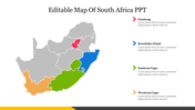
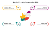
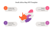
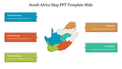
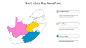
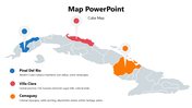
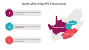
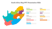
This Single slide is part of a multicolor presentation packed with customizable map templates, clean vector graphics, and editable text areas. Compatible with PowerPoint, Google Slides, and Canva for hassle-free editing. Create map infographics and geo-data visuals in minutes. Download the Map Presentation PowerPoint slide today and transform your geographic data into clear, impressive presentations that captivate clients, teams, or students!
Finland Map PowerPoint Presentation And Google Slides


Finland Map PowerPoint, Google Slides & Canva Template
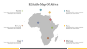
Finland Map Presentation PowerPoint slides are powerful tools for presenting geographic data, regional insights, and location-based strategies. Well-designed maps make it simple to showcase global reach, market expansion plans, travel routes, sales territories, and demographic reports in a visually engaging format.
Purpose of the Slide Deck
This single slide features an editable Map Presentation PowerPoint layout in a modern multicolor theme. It includes vector world maps, country highlights, and pinpoint markers. Users can customize regions, add data labels, and change colors to match their brand identity. This slide helps convey complex geographical information in a clear, polished, and professional manner, ideal for business meetings, academic research, or marketing reports.
Who Can Use It?
Perfect for marketing managers, business analysts, sales strategists, travel planners, educators, and students. Whether presenting international business growth, regional sales performance, or tourism statistics, this map slide makes data storytelling simple and compelling for all audiences.
Special Key Features
- 100% customizable slides and easy to download.
- The slides contain 16:9 and 4:3 formats.
- Easy to change the colors quickly.
- Highly compatible with PowerPoint, Google Slides, and Canva templates.


You May Also Like These PowerPoint Templates
Add to Wishlist
Download
AI Customize

Add to Wishlist
Download
AI Customize

Add to Wishlist
Download
AI Customize


Add to Wishlist
Download
AI Customize

Add to Wishlist
Download
AI Customize

Add to Wishlist
Download
AI Customize

Add to Wishlist
Download
AI Customize


Add to Wishlist
Download
AI Customize

Add to Wishlist
Download
AI Customize

Add to Wishlist
Download
AI Customize

Add to Wishlist
Download
AI Customize

Add to Wishlist
Download
AI Customize

Add to Wishlist
Download
AI Customize

Add to Wishlist
Download
AI Customize

Add to Wishlist
Download
AI Customize

Add to Wishlist
Download
AI Customize

Add to Wishlist
Download
AI Customize
