Precise Oregon State County Map PPT Template Presentation

Precise Oregon State County Map PPT Template Presentation
P.ID : 59906
    110 views
    22 Downloads
    Get Custom Slides by Experts
    Instantly Access Templates in PowerPoint

    Precise Oregon State County Map PPT Template Presentation


    Download Precise Oregon State County Map PPT Template Presentation to display location and other geographic aspects in your presentation. This template helps you in all kinds of data representations. This is a geographical-themed template.


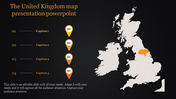
    This Precise Oregon State County Map PPT Template Presentation has the political outline map of the Oregon region. There are some highlighted smaller regions with bright colors. Oregon is the ninth largest and one of the most populous U.S. state, with Salem as its capital. 


    This is a four nodded template. The nodes are positioned on the right part of this template, near the outline map. Each node represents the districts in Oregon province.


    Use this extensive geographically themed template for all your presentations. This template will help you to leave an enduring impact on the audience.


    Features of this template:

    • 100% customizable slides and easy to download.
    • Slides available in different nodes & colors.
    • The slide contained 16:9 and 4:3 format.
    • Easy to change the slide colors quickly.
    • Well-crafted template with instant download facility.
    • Geographically themed template with outline map.
    • Pre-designed template with budget-friendly access.
    Advertisement

    You May Also Like These PowerPoint Templates

    Add to Wishlist
    Download
    AI Customize
    PowerPoint template showing a world map with color coded regions and percentages with placeholder text.
    Add to Wishlist
    Download
    AI Customize
    Europe map template showing percentages for different colored regions, with captions for each section on a white backdrop.
    Free
    Add to Wishlist
    Download
    AI Customize
    Slide with a globe highlighting Africa connected with three percentage based labels and a bar chart on the top right.
    Free
    Add to Wishlist
    Download
    AI Customize
    PowerPoint template with a world map and icons representing cars, trucks, and buses, with placeholder text beside each icon.
    Add to Wishlist
    Download
    AI Customize
    Europe map slide with colored markers highlighting percentages for different regions with placeholder text.
    Add to Wishlist
    Download
    AI Customize
    Southern USA states highlighted in various colors with a legend listing states like Louisiana, Georgia, and Oklahoma.
    Add to Wishlist
    Download
    AI Customize
    World map with countries highlighted in different colors, each labeled with a country name in a text box.
    Add to Wishlist
    Download
    AI Customize
    USA map with three labeled states, connected to pie charts illustrating marketing distribution percentages.
    Free
    Add to Wishlist
    Download
    AI Customize
    Gray world map made of dots with color-coded location markers and captions aligned on the right side.
    Free
    Add to Wishlist
    Download
    AI Customize
    Business slide with a purple map, text areas, circular icons for steps, and gears symbolizing process on the right.
    Add to Wishlist
    Download
    AI Customize
    US map template with selected states highlighted in blue, green, and purple, paired with matching captions below.
    Free
    Add to Wishlist
    Download
    AI Customize
    South Africa map with highlighted regions and three labeled boxes in green, red, and yellow, connected to numbered circles.
    Free
    Add to Wishlist
    Download
    AI Customize
    PowerPoint map slide featuring multiple countries with captions pointing to specific locations on the world map.
    Add to Wishlist
    Download
    AI Customize
    Gray Turkey map with red location markers, text sections, and a horizontal line with colorful labels below.
    Add to Wishlist
    Download
    AI Customize
    World map infographic with six colorful numbered markers, each highlighting a continent with a label and description.
    Free
    Add to Wishlist
    Download
    AI Customize
    US map with state markers in orange, green, teal, and blue, showing corresponding color coded progress bars.
    Free
    Add to Wishlist
    Download
    AI Customize
    Map of Europe with two countries highlighted in maroon and teal, with a circular chart displaying percentages.