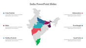
India continent Map PowerPoint Template Presentation Slide

Map of India highlighting different states and neighboring countries, with placeholder labels.
P.ID : 36031
    2.9K+ views
    357 Downloads
    Get Custom Slides by Experts
    Instantly Access Templates in PowerPoint

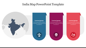
    Fully Loaded Patriotic India Map

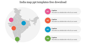
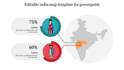
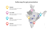
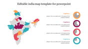
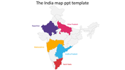
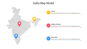
    Use this extremely valuable India map inserted template to use it on your slides directly. Through this renowned template, you can talk about the culture, the unity in diversity, and many other topics practiced in India. You can relate to many political and geographical themes as well as the places mentioned here. The divine India map diagram and the highlighted regions assist in your explanation process. So, download this easy-to-use template and create public-spirited presentation slides.

    Features of this template

    • 100% customizable slides and easy to download
    • Slides are available in different nodes & colors.
    • The slides contained 16:9 and 4:3 formats.
    • Easy to change the slide colors quickly.
    • Well-crafted template with instant download facility.
    • Highly compatible with PowerPoint, Google Slides, and Canva Presentation.
    • Industrious designs are inserted.
    Advertisement

    You May Also Like These PowerPoint Templates

    Add to Wishlist
    Download
    AI Customize
    Global map with statistical highlights for four countries, including percentages and colored markers.
    Add to Wishlist
    Download
    AI Customize
    Map of Europe with three colorful target markers and placeholder text areas placed in a white backdrop.
    Add to Wishlist
    Download
    AI Customize
    Global map visualization showing numbered country markers for Canada, Brazil, Denmark, Africa, Russia, and Australia.
    Add to Wishlist
    Download
    AI Customize
    Asia map in gray with northern regions highlighted in red, and descriptive text on the right.
    Add to Wishlist
    Download
    AI Customize
    Gray USA map highlighting states in blue and green, with text sections and circular graphs below.
    Add to Wishlist
    Download
    AI Customize
    Global map featuring five countries in red, blue, green, orange, and purple, with text boxes linked to each.
    Add to Wishlist
    Download
    AI Customize
    Circular chart with percentages surrounding a map of Indonesia in the center, with sections in various colors.
    Add to Wishlist
    Download
    AI Customize
    Asia map slide with transport icons including airplane, bus, car, train, and boat for different regions.
    Add to Wishlist
    Download
    AI Customize
    World map slide highlighting different regions with percentage markers, showcasing various data points across continents.
    Add to Wishlist
    Download
    AI Customize
    Gray map of China with six colorful location pins marking regions and text boxes on both sides for details.
    Add to Wishlist
    Download
    AI Customize
    PowerPoint slides showcasing a map of the USA with regional color coding and infographics.
    Add to Wishlist
    Download
    AI Customize
    Gray world map with color highlights for USA, Russia, Brazil, and Australia, alongside a bar chart showing data percentages.
    Add to Wishlist
    Download
    AI Customize
    Gray world map with five percentage data points in colored boxes over various continents, displaying statistical values.
    Add to Wishlist
    Download
    AI Customize
    Map with data points in colored circles, left side includes a text area and data infographic.
    Add to Wishlist
    Download
    AI Customize
    Editable PowerPoint About Ireland Presentation Designs
    Add to Wishlist
    Download
    AI Customize
    A Maryland map silhouette with labeled locations such as Towson, Baltimore City, and Annapolis on a white backdrop.