Simple US Map Template PowerPoint Presentation Design

US map filled with the American flag, surrounded by seven colorful circles labeled with placeholder text in an arc layout.
P.ID : 59918
    109 views
    21 Downloads
    Get Custom Slides by Experts
    Instantly Access Templates in PowerPoint

    Simple US Map Template PowerPoint Presentation Design


    Download this Simple US Map PowerPoint Presentation Design template for all your geographical representations. This is a professionally and well-designed template. 

    The United States of America is one of the North American nations with the world’s most dominant economic and military power. It is officially named the United States of America, with Washington, D.C. as its capital.

    Use this Simple US Map Template PowerPoint Presentation Design template to display all the information related to the U.S. region. This template has the map outline of the U.S. province. The U.S. region is filled with the picture of its own flag. The flag consists of white and red stripes and a blue rectangle at the top-right corner with 50 white stars.

    This is a six nodded template. The nodes are arranged in an arc-shaped order around the map outline. Each node is denoted with a colored circle icon. They have a description space for further details.

    Use this delicate and elegant template for all your geographical data representations to impress the audience with an amazing sense of experience.

    Features of this template:

    • 100% customizable slides and easy to download.
    • Slides available in different nodes & colors.
    • The slide contained 16:9 and 4:3 format.
    • Easy to change the slide colors quickly.
    • Well-crafted template with instant download facility.
    • Pre-designed template at an economical cost.
    • Stunning six nodded template with map outline feature.
    Advertisement

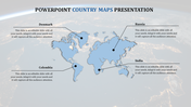
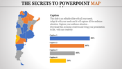
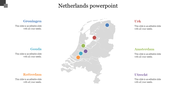
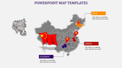
    You May Also Like These PowerPoint Templates

    Free
    Add to Wishlist
    Download
    AI Customize
    Ecuador country map with six labeled location pins for cities like Ibarra, Nueva, Montalvo, Riobamba, Macas, and Santa Elena.
    Add to Wishlist
    Download
    AI Customize
    Blue shaded Great Britain map showing regional populations, alongside two percentage circles and a numbered list.
    Add to Wishlist
    Download
    AI Customize
    World map with six labeled location markers and travel path, set against a bright blue background.
    Free
    Add to Wishlist
    Download
    AI Customize
    PowerPoint slide with a Netherlands map showing four points corresponding to the years 2017 to 2020 with captions.
    Add to Wishlist
    Download
    AI Customize
    Gray world map showing global points in yellow, red, pink, green, and purple, and dotted lines connecting them.
    Add to Wishlist
    Download
    AI Customize
    Editable Tokyo PowerPoint Presentation Slide Template
    Add to Wishlist
    Download
    AI Customize
    Africa PowerPoint template featuring a color coded map, dividing the continent into yellow and green regions for clarity.
    Add to Wishlist
    Download
    AI Customize
    World map infographic with countries in blue and a table listing sessions, goals, conversion rates, and bounce rates.
    Add to Wishlist
    Download
    AI Customize
    Country maps of the UK, Germany, and Italy in blue, red, and green, each labeled with percentage progress bars.
    Add to Wishlist
    Download
    AI Customize
    3D spinning globe with a focus on continents, surrounded by four numbered captions in a white backdrop.
    Free
    Add to Wishlist
    Download
    AI Customize
    Buy bright and best Brazil PPT Template Free Download
    Add to Wishlist
    Download
    AI Customize
    World map with regions highlighted in yellow, green, and pink, representing South America, Europe, and Australia with text.
    Add to Wishlist
    Download
    AI Customize
    World map slide showing labeled continents and oceans from North America, Asia, Africa, Australia, and Antarctica.
    Add to Wishlist
    Download
    AI Customize
    World map PowerPoint slide highlighting North America, Europe, Russia, and China with respective population data.
    Add to Wishlist
    Download
    AI Customize
    Highlighted U.S. states, including Washington, California, Texas, and Florida, with text placeholders on the right.